
Trace a Roseville Street by Address
For a Roseville address, begin with the text exactly as it appears in the source and note that source's date. A parcel record can identify an owner or tax mailing address, but it does not prove who is physically present. A deed establishes a recorded transfer, and a historical directory is a dated printed listing. Keeping those layers apart makes a Roseville street directory result much more useful. The quickest chain starts with the map, moves to the parcel, then tests the name and legal description in land records before turning to historical material.
- Search the address in Macomb GIS Parcel Explorer, selecting Roseville as the community when the search offers that choice.
- Record the returned parcel or Sidwell number, the mapped address point, and the legal description if displayed.
- Check the Roseville Assessor and BS&A record path for the current property layer.
- Use the parcel, legal description, or party name in the Macomb Register of Deeds search options to follow recorded transfers.
- Use Michigan Voter Information Center only for an individual status question; a lawful Roseville-jurisdiction voter extract follows the written Qualified Voter File request route and does not prove presence at an address.
- For a dated household clue, compare available historical directories, newspapers, and cross-indexes through the Roseville library system.
Roseville records can disagree because they were created for different purposes. Treat a Roseville result as a lead until a second Roseville source supports the same address and date. Note: A parcel boundary, a mailing label, and an address point can describe the same Roseville place without carrying the same date or meaning.
Use Roseville GIS Address Fields
Macomb County's public GIS is the strongest Roseville street-search tool for turning a road address into a mapped parcel. The official guide documents searches by intersection, tax ID, property address, and all known address. For a Roseville property-address search, use a full or partial address, choose the Roseville community, and omit suffixes such as RD, DR, AVE, BLVD, and CT when a search misses. The all-known-address route can search E911 address points and a property name. It may show individual units only when the address-points layer is selected.
| Roseville GIS search | Inputs | Useful result | Important limit |
|---|---|---|---|
| Roseville property address | Full or partial address and community | Roseville parcel result and map zoom | Suffixes may need to be omitted. |
| Roseville tax parcel | Full or partial Sidwell number | Selected Roseville parcel and linked result | Copy a number from a current record; do not infer one. |
| Roseville all known address | Address, community, or property name | Roseville E911 address-point result | Address-point layer must be selected for map results. |
| Roseville intersection | Two street names | Mapped Roseville intersection | It identifies a location, not a parcel owner. |
The guide also supports Identify, Buffer, Measure, Print Map, and map-image tools. Those functions help document a Roseville street relationship, nearby parcels, or a dated map view. They do not turn the viewer into a certified land record.
Roseville Property Search Routes
The municipal BS&A Online landing for Roseville lists address, name, and parcel-number searching along with assessment, tax, sale, permit, license, special-assessment, and utility-service links. The stable public material did not establish every field, date range, or result display for those services. Use the landing as a route to the relevant municipal record, then confirm a title question through the Register of Deeds. Roseville assessment information can help explain an assessed or taxable value, but it is not a complete household roll.
Start with the official BS&A landing shown below when you have an address, a name connected to a parcel, or a parcel number. It is a source page, not evidence that a particular service exposes every historical record.
The Roseville BS&A municipal search landing is the source for this captured search route.
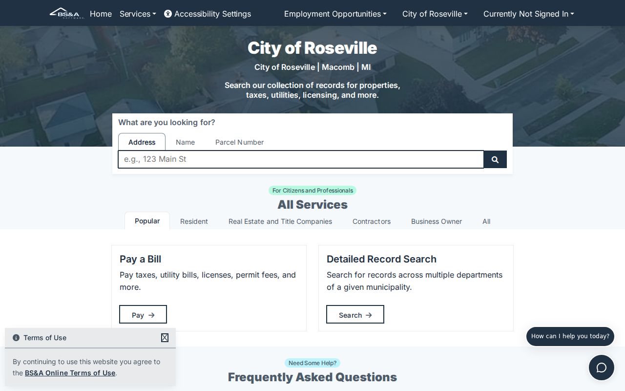
The captured landing confirms the available service categories, while the research record preserves the limits on unverified live field details.
Match Roseville Streets to Old Names
Historic Roseville street research often fails because the road name changed. The Roseville Historical & Genealogical Society's city-posted research identifies Gratiot as Erin Plank Road, 11 Mile as Townhall Road, 12 Mile as Champagne Road, 13 Mile as Cushy Road, and Frazho as Roseville Road and Bloss Road. Masonic also appears as Meier or Meyer Road and Five Mile House Road. Keep the old spelling in Roseville notes, then add the modern Roseville road as a cross-reference.
Jurisdiction labels change too. The area was Orange Township, then Erin Township from 1843; Roseville was a village in 1875 and a city in 1958. A Roseville address in an older atlas, newspaper, or directory can therefore appear under Erin Township, a village label, East Detroit-area geography, or a county description. The former Erin Township Hall near Gratiot and 11 Mile disappeared during I-696 construction in the 1970s, so a current map cannot be expected to show the earlier civic landmark.
Note: Preserve the road and jurisdiction exactly as printed before adding a modern Roseville comparison.
Roseville Records by Street
Several custodians hold address-keyed Roseville evidence, and each has a narrower purpose than a street-wide roster. The Assessor and BS&A provide the municipal property layer. Macomb GIS locates parcel and address features. The Register of Deeds holds recorded instruments. Roseville Building records can tie work to a project location, while the City Clerk can route land-file and Freedom of Information Act questions. Combining the records by parcel and date is more reliable than relying on a name alone.
| Roseville address record | Custodian | What it can establish | Access path |
|---|---|---|---|
| Roseville assessment or tax record | Roseville Assessing | Property, mailing, value, exemption, sale, or parcel fields where public | Roseville Assessor and BS&A services |
| Roseville parcel map | Macomb GIS | Roseville boundary, address point, tax ID, layers, and adjacent features | Free public viewer |
| Roseville recorded instrument | Macomb Register of Deeds | Grantor, grantee, date, document, and legal description when indexed | Basic, advanced, terminal, staff, or mail search |
| Roseville permit or code file | Roseville department | Project location, work, case activity, or responsible party where releasable | Department request or FOIA route |
| Roseville historic directory | Libraries and archives | Dated printed name-to-address clue | Roseville reference collection and research request |
A tax account is not proof of current presence, and a building form is not proof of continuous presence. The records become useful when their dates, exact address form, parcel number, and custodian are recorded together.
Follow Roseville Deeds Along a Street
The Macomb Register of Deeds records deeds, mortgages, liens, lis pendens, and federal tax liens. Its Basic Document Search supports free index research, while online document copies are listed at $6. Advanced access supports address, legal-description, parcel-ID, and name searches. Public terminals offer free index viewing. A staff search is listed at $5 per search plus $1 per page, and a mail request should include the document type, parties, approximate date, and address, legal description, or lot.
Search the present grantee, capture the recording date and legal description, then search that party as a prior grantee using the same legal description. The county warns that documents may not yet be fully indexed or verified. In that transition, basic searching should use the first grantor or first grantee. A zero result can reflect status, spelling, or the wrong instrument rather than an absent Roseville record.
Macomb's Register of Deeds search-options page documents the online, terminal, staff, and mail paths.
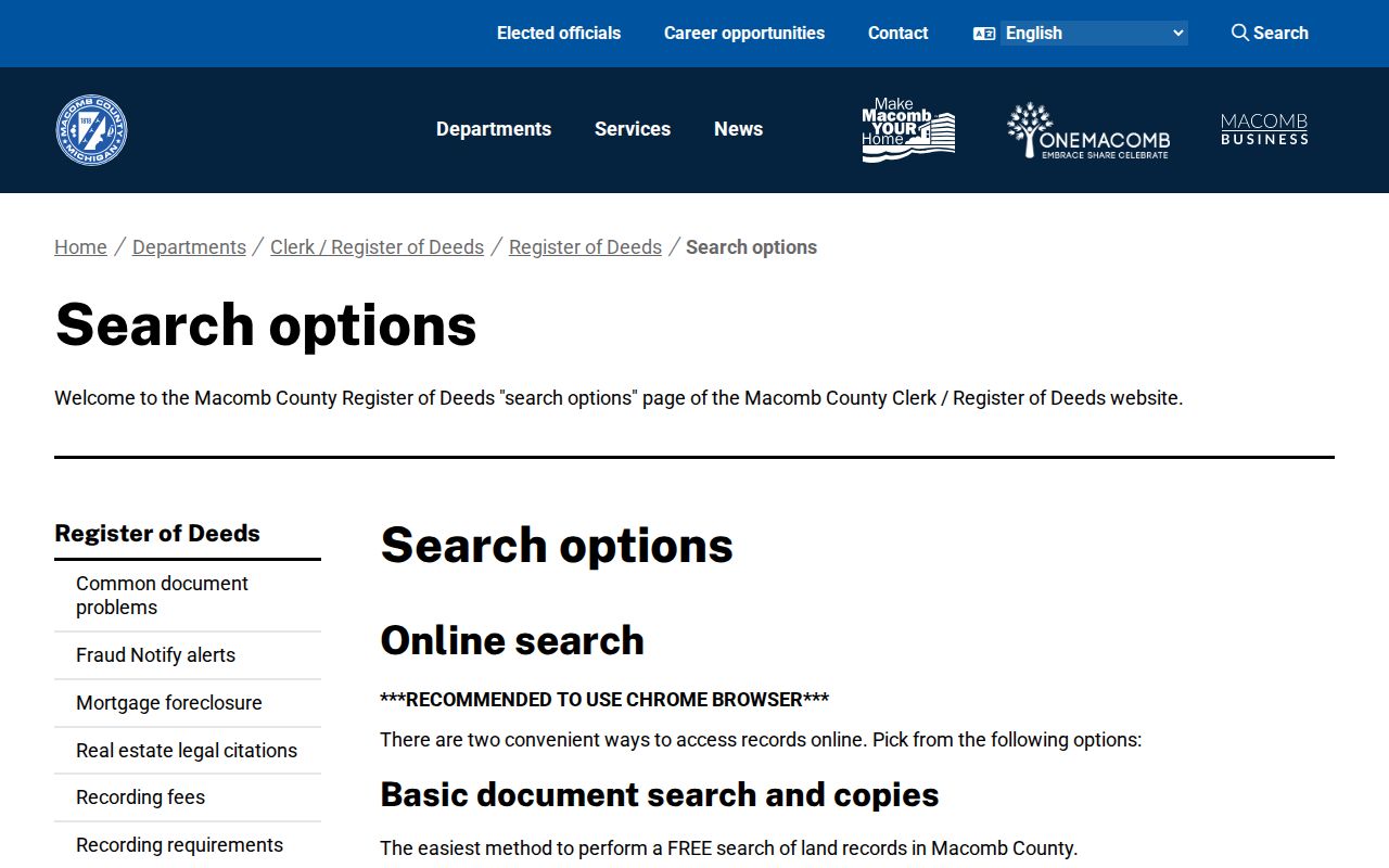
The official Macomb page shows that Roseville address work can continue through more than one channel when a Roseville online index is incomplete.
Roseville Address Terms Defined
Use the same terms in every Roseville address note. That keeps a Roseville postal label from being confused with the legal land description used in a recorded deed.
- Parcel or Sidwell number
- A tax-map identifier used to connect a Roseville parcel with assessment and GIS records.
- Situs address
- The address assigned to the property itself, which can differ from the owner's mailing address.
- E911 address point
- An emergency-mapping feature that locates an address; it is not the parcel's legal description.
- Legal description
- The lot, block, subdivision, or other land wording used to identify property in a deed.
- Criss-cross directory
- An address-order directory section, if an edition has one; Roseville's confirmed years and layout remain to be verified.
This vocabulary is especially important where Roseville addresses have units, older road names, or municipal-boundary context. It also makes a Roseville request to a Roseville custodian more precise.
Roseville Permit and Clerk Files
The Roseville City Clerk keeps city land files and routes records questions. Building records are address-centered: the city form captures a project location, owner contact, contractor and license information, dimensions, work description, estimated construction cost, permit number, fees, and issue date. A permit can date a project or identify an applicant in the record, subject to redaction and the city's access rules. It cannot establish every person who lived there.
When a needed item is not in a public interface, use Roseville's written FOIA request form for a narrow, record-specific request. Michigan's Freedom of Information Act is MCL 15.231 et seq. Name the address, date range, department, and record type rather than asking a general question about a person.
Separate Roseville ZIPs and Parcels
Roseville's principal postal ZIP is 48066, and the USPS lists the Roseville Post Office at 30550 Gratiot Avenue with 48066-9998. That helps standardize a mailing address, but a ZIP is postal routing rather than a city boundary or a parcel description. For a street search, compare the postal result with the Roseville address, the Macomb GIS community selection, and the parcel's legal description.
Street research should also distinguish an address from an E911 point and a legal parcel. A road can cross municipalities, a historic road can be renamed, and an old directory can use a rural or business label. Keep the source date beside every version. For a ZIP-first question, the Roseville ZIP Codes page explains the delivery geography without replacing the street-by-street record chain.
Note: Use USPS for delivery format and Macomb GIS for parcel context when a Roseville street result seems inconsistent.
Roseville Street History Evidence
For a historical Roseville street-record question, pair modern mapping with the 1875 Combination Atlas, the 1916 Standard Atlas, and the 1956 Rockford Farm Plat Book identified in the Library of Michigan Macomb guide. Those sources can show Roseville lots, roads, owners, and township context before today's Roseville parcel map. The Roseville Record survives for 1926 through 1931, and the South Macomb News and selected Macomb Daily microfilm extend the newspaper trail.
The Roseville Library's house-history method recommends retaining the full address, legal description, or lot number, then comparing deeds with plat maps, directories, newspapers, census schedules, architectural surveys, and nearby properties. The public research does not verify which Roseville editions contain a reverse section. Historical cross-indexes should therefore be treated as a repository question, not assumed to be available in every year. The historical collections are described in greater detail in the Roseville Directory Book.
Limits of Roseville Address Searches
No Roseville street search can establish every household member or produce a complete current list for a Roseville road. Utility customer lists, protected motor-vehicle information, confidential Roseville addresses, juvenile information, and many other fields are not a public address index. Michigan voter records also withhold items such as phone, email, signature, month and day of birth, driver-license or state-ID number, and the last four Social Security digits. A map full of Roseville parcels does not reveal who is inside.
Michigan's Address Confidentiality Program can also place a designated address into certain government interactions for eligible safety-risk participants. A missing result may reflect a redaction, an exemption, a substitute address, or a different custodian. Do not try to reconstruct a confidential address from parcel, election, court, or library material.